maps
In addition to the striking design of Earth's curated and natural landscapes from modern satellites, I'm interested in two levels of narrative with these maps: One being the direct visual interaction between actors in the foreground and the maps behind them, and two being the maps themselves as a barometer of our separation from nature.
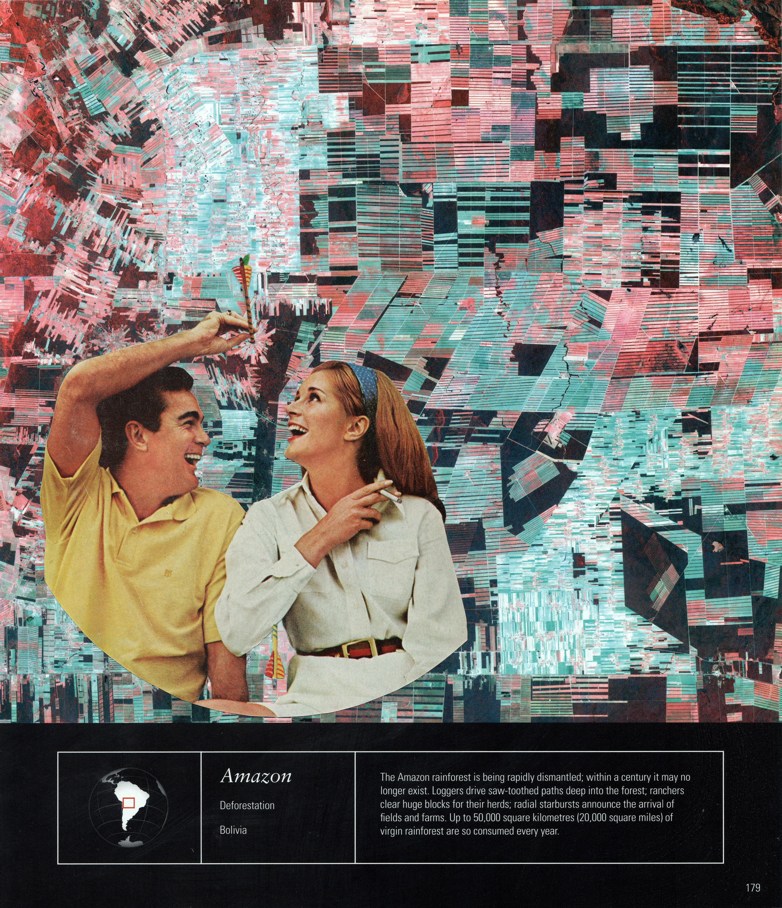
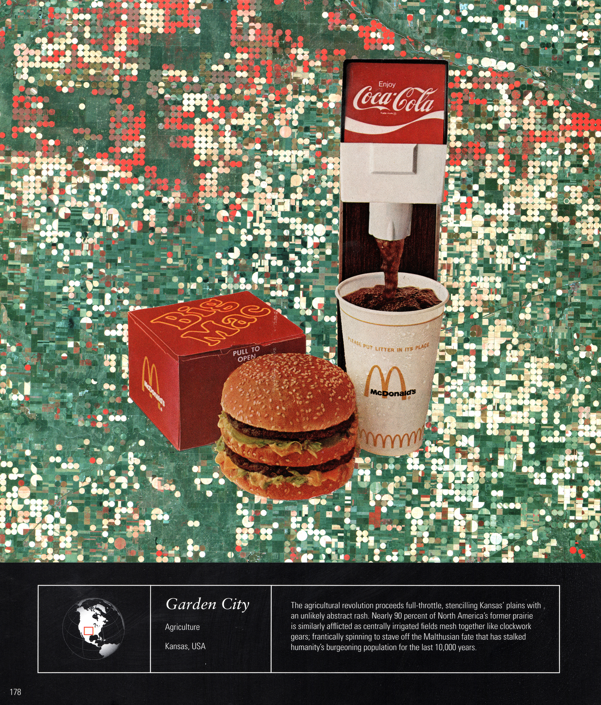
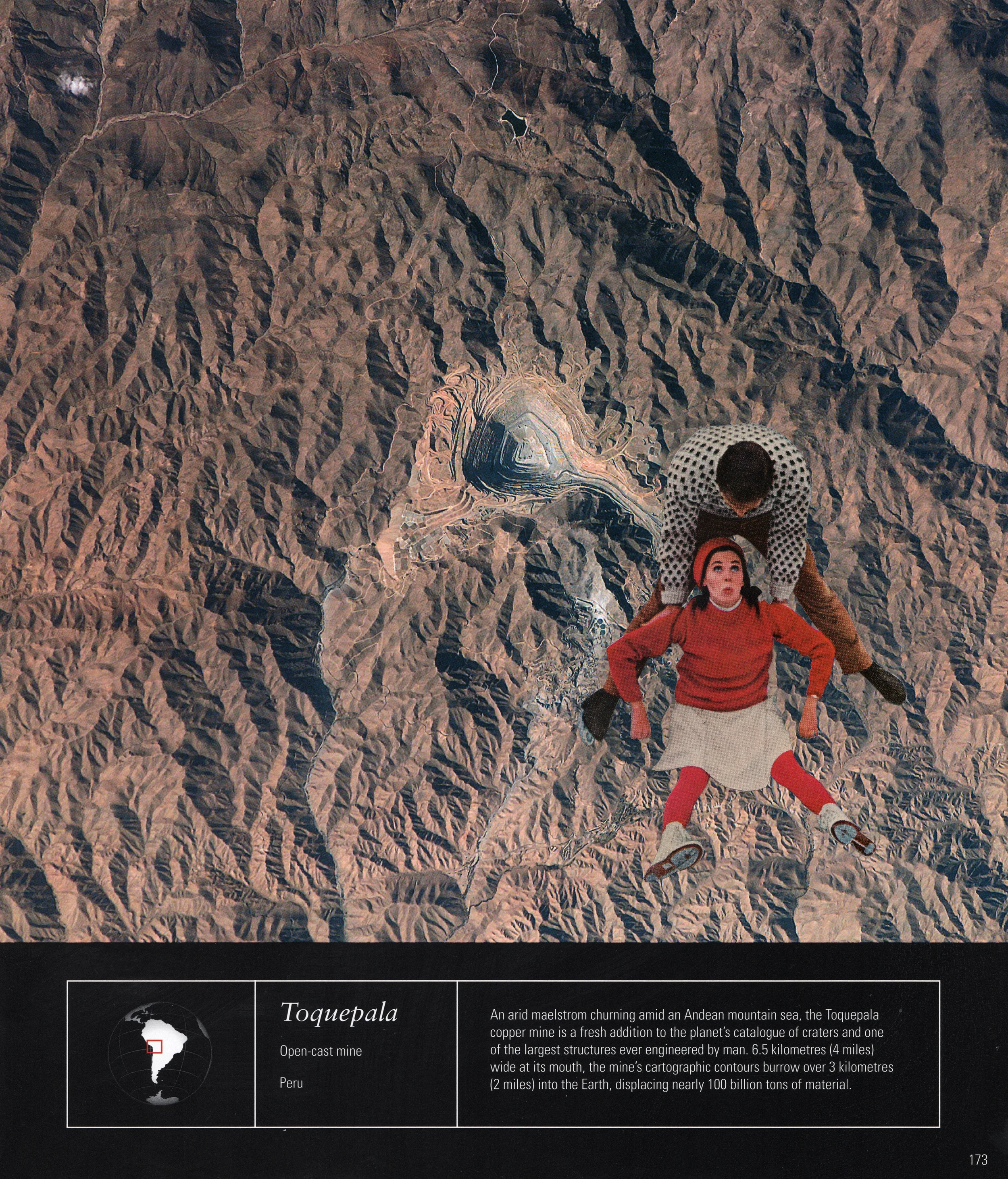
Taken mostly from vintage LIFE and LOOK magazines dating from the 1970-80s, I couldn't help but take pleasure in the level of calm, poise, and joy exhibited in everyday advertisements and news articles, however manufactured it may be. I juxtaposed this incredibly intoxicating veneer of ease and comfort with maps of various environmental crises - deforestation, melting glaciers, open-cast mines, desiccated lakes, ever-expanding irrigation, oil fires, etc. This collision of vintage humor with present planetary conditions sheds light both on the roots of environmental and social ills and our often cursory reaction to them - reactions which often belie and, as a result, exacerbate the depth of the problem.
The second level of narrative involves the maps themselves. As geographical imagery of landmarks and landscapes from satellites, these maps represent an advance in human separation from nature which I believe to be part of the root of the environmental and climate crises. Not only have we created the various environmental problems themselves, but we have created ways to capture them from space on a scale previously deemed impossible, a stinging irony brought to life by the vintage characters. With the advance of the scientific method and now with the creation of a consumer economy based on endless growth and artificial obsolescence, we separate, distill, and analyze nature, creating further separation and hierarchy between what is “natural” and what is human, solely to benefit select members of the human community.
08/08/16